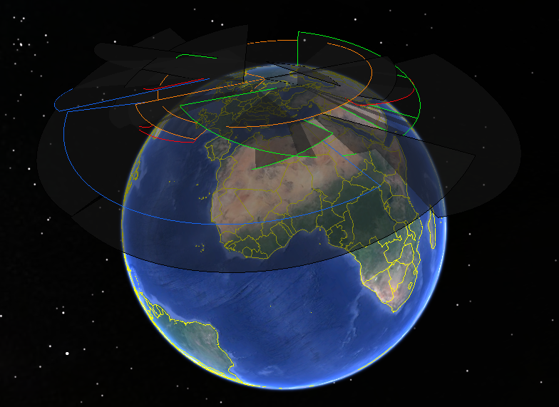
 The Soviet Union built a lot of early-warning radars (I wrote about it a while back and then again). Most of them, however, ended up outside of Russia after the breakup of the Soviet Union. Those that are still operating are getting rather old, so Russia has been building an almost entirely new early-warning radar network. I tried to collect all these radars - past, current, and future - in one place, or, rather, one Google Earth file. Here it is - Russian Early-Warning Radars 2018.kmz.
The entire picture is quite busy, so I tried to add a color scheme to the file to make it easier to read. Those radars that are no longer operational (some of them have been demolished) are in black and hidden by default. The old Soviet radars that are still in service are blue. The missile-defense radars around Moscow are orange. Of the new ones, Voronezh-M and Voronezh-VP are red and Voronezh-DM are green. I hope that the file gives some idea of how the new radars are replacing old ones and how the different types of radars complement each other. It takes some clicking, though.
The numbers for range, minimum elevation and azimuth coverage are taken from the map that was seen in the Main Space Situational Awareness Center. For some older radars, especially the Dnestr and Dnepr deployed in Skrunda, Mishelevka, and Balkhash, these are largely guesses.
Comments, corrections, and interesting observations are welcome.
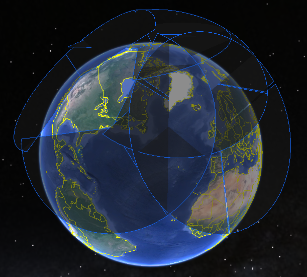
UPDATE: There is a file for the United States too - U.S. Early-Warning Radars 2018.kmz. It's not as colorful, though:
The book
Post a comment