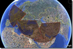
 I'm wondering if this is the site of the Voronezh-class radar that is built near Armavir - 44°55'52.20"N 40°59'21.38"E. It's an October 23, 2005 shot on Google Earth, so we don't get to see the actual radar. At the same time, it looks reasonably similar to the site in Lekhtusi (60 16'31.47"N 30 32'41.96"E) and points in what seems to be the right direction - south-west, covering the gap in coverage between the Baranovichi and Gabala that was created after Russia decided to stop using the radars in Ukraine.
The radar in Armavir was supposed to begin service in December 2007, which then became 2008, and now apparently is at least 2009 - we haven't heard anything about the Armavir radar being operational. (I actually doubt the early report about this radar operating in December 2006 told the entire truth.)
UPDATE 02/11/09: Important update - there are two radars there, in a somewhat different location.

Comments
Hi Pavel!
Have a look at the "Russian Google Earth":
http://www.kosmosnimki.ru/#x=40.985010&y=44.926085&z=14&fullscreen=true&mode=satellite
There is a structure visible at 44°55'30.38"N 40°59'2.02"E .
But the delay in the construction is remarkable - specially when we take into account the loss of sites in the Ukraine.
Cheers
Bernd: Thank you. This is interesting. I wish Google had a more recent image.